On Display: Online mapping, spatial data and geo-referenced information in Kenya and Ushahidi-updates in Africa
November 11, 2011 2 Comments
In Kenya some new interactive platforms and initiatives visualize and connect spatial data to other forms of data in most innovative ways:
Virtual Kenya
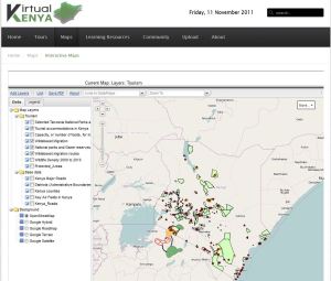
Virtual Kenya is designed to provide improved access to spatial data and mapping technology to allow more Kenyans to use and interact with spatial data in their educational and professional pursuits. This will be accomplished by providing online access to publicly available spatial data sets and by offering users a number of interactive tools and learning resources for exploring these data. Users will be able to view, download, publish, share, and comment on various map-based products. The ultimate goal of Virtual Kenya is to promote increased data sharing and spatial analysis for better decision-making, development planning and education in Kenya, while at the same time demonstrating the potential and use of web-based spatial planning tools.
 Initially, the platform will feature maps and information based on Nature’s Benefits in Kenya: An Atlas of Ecosystems and Human Well-Being (“the Atlas”), originally published jointly in 2007 by the World Resources Institute together with the Department of Resource Surveys and Remote Sensing, the Central Bureau of Statistics, and the International Livestock Research Institute. The Atlas overlays geo-referenced statistical information on human well-being with spatial data on ecosystems and their services to yield a picture of how land, people, and prosperity are related in Kenya. Since its publication, data and charts from the Atlas have been downloaded regularly from the WRI website, and its online Geographic Information System (GIS) data sets are being used to produce new maps.
- interactive maps with multiple layers (e.g. Tourism, Biodiversiy, Water Points)
- Virtual Kenya Tours are interactive Google Earth tours , e.g. on The Geography of Kenya or Wildlife and Tourism Tour.
Virtual Kenya was implemented by Upande Ltd. Upande focuses on providing services which address problems related to location, direction and destination, with a strong focus on online mapping and Geographical Information Systems (GIS). Upande is also involved in developing the ALRMP baseline prototype application for the Ministry of Northern Kenya and Arid Lands. The company also worked for the African Union Inter African Bureau for Animal Resources (AU-IBAR) to create a single-stop bank of information on animal resources in Africa with a web map for the dissemination of knowledge on animal health, animal production and livestock marketing and trade. Also not online is the E-commerce web map page for SORALO (South Rift Land Owners Association) and ATAGRA (Amboseli Tsavo Group Ranch Association), Group Ranch Associations based in the Maasai Mara and Amboseli ecosystems to boost tourism outside of the conventional parks by making information on hotspots searchable to the world. Upande also offers consultancy in Google Map, OpenStreetMap (OSM), OpenLayers, Mapserver, Geoserver and Geonetworks.
Map Kibera
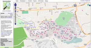
 Map Kibera has produced the first complete free and open map of Kibera. In November 2009, local young people used OpenStreetMap techniques. This included surveying with GPS, and digitization of satellite imagery and paper based annotation with Walking Papers. In April 2010, Map Kibera started two media and local news reporting groups formed to elaborate on information in Kibera. Kibera News Network uses handheld Flip video cameras to record local news and stories and edit videos to post on Youtube and share in the community. To support Map Kibera Erica Hagen and Mikel Maron founded the GroundTruth Initiaive. They aim on using digital story-telling, open data and geographic information for greater influence and representation for marginalized communities.
Voice of Kibera
Voice of Kibera uses Ushahidi software to map local stories and reports onto the Kibera map, and serve as a local information hub. This citizen reporting project is an initiative of Map Kibera. Voice of Kibera aims to give collective global voice to Kibera residents by aggregating local citizen reports, Kibera community media and other relevant news and information.
Kenya Open Data
The goal of opendata.go.ke is to make core government development, demographic, statistical and expenditure data available in a useful digital format for researchers, policymakers, ICT developers and the general public. Includes e.g. high quality national census data, government expenditure, parliamentary proceedings and public service locations. There are maps to start exploring, interactive charts and tables for a deeper understanding, and raw data for technical users to build their own apps and analyses.
RCMRD
The Regional Centre for Mapping of Resources for Development (RCMRD) was established in Nairobi, Kenya, under the auspices of the United Nations Economic Commission for Africa and the African Union. It is an inter-governmental organization and currently has 18 contracting Member States in the Eastern and Southern Africa Regions. Its vision is to be a centre of excellence in the provision of Geo-Information and Information Technology applications in Africa and beyond.
Further virtual maps
- AfricaMap is housed at the Center for Geographic Analysis at Harvard University
- websites with individual maps or with collections of maps in ilissAfrica
Ushahidi-Updates
Many new Ushahidi-sites have been started since my first Blog post from March 2011 “On Display: Crowdsourcing with Ushahidi – the social and political relevance of the interactive web“:
Liberia:
- Peace Building Office of the Republic of Liberia.
- Liberia’s Early-Warning and Response Network (LERN)
- Liberia Elections 2011 – live Ushahidi election monitoring website
- compare also Ushahidi Liberia as a non-profit tech company that customise free and open source software for information collection, visualization and interactive mapping in Liberia.
Benin:
- Violence Against Children project – Plan Benin uses Ushahidi to map reports of violence against children in Benin. Children, youth and even adults can use SMS to send in reports on violence against children. The goal is to both collect information about the forms and occurrences of violence as well as to strengthen local and national capacity in participating countries to respond to violence against children. It is hoped that the information collected can also serve to shape programs and budgets dedicated to ending this harmful practice.
- Lagos Traffic – Monitoring Traffic in Lagos, Nigeria
- 2011 election incident report system
Zimbabwe:
- The National Association of NGOs in Zimbabwe (NANGO) has launched a social service delivery campaign in Harare for residents to speak on problems they are facing in their neighborhood.
Zambia:
- BantuWatch – platform that allows citizens and civil society to monitor and report incidences around the electoral process in 2011.
South Africa:
- Petrol reports in South Africa
Egypt:
- HARASSmap – a system in Egypt for reporting incidences of sexual harassment via SMS messaging.
Morocco:
- Moroccans are participating in election monitoring on Marsad.ma (Marsad, in Arabic, means Observatory).
Please add more innovative sites with spatial data as comments on this article!


